Chelsea
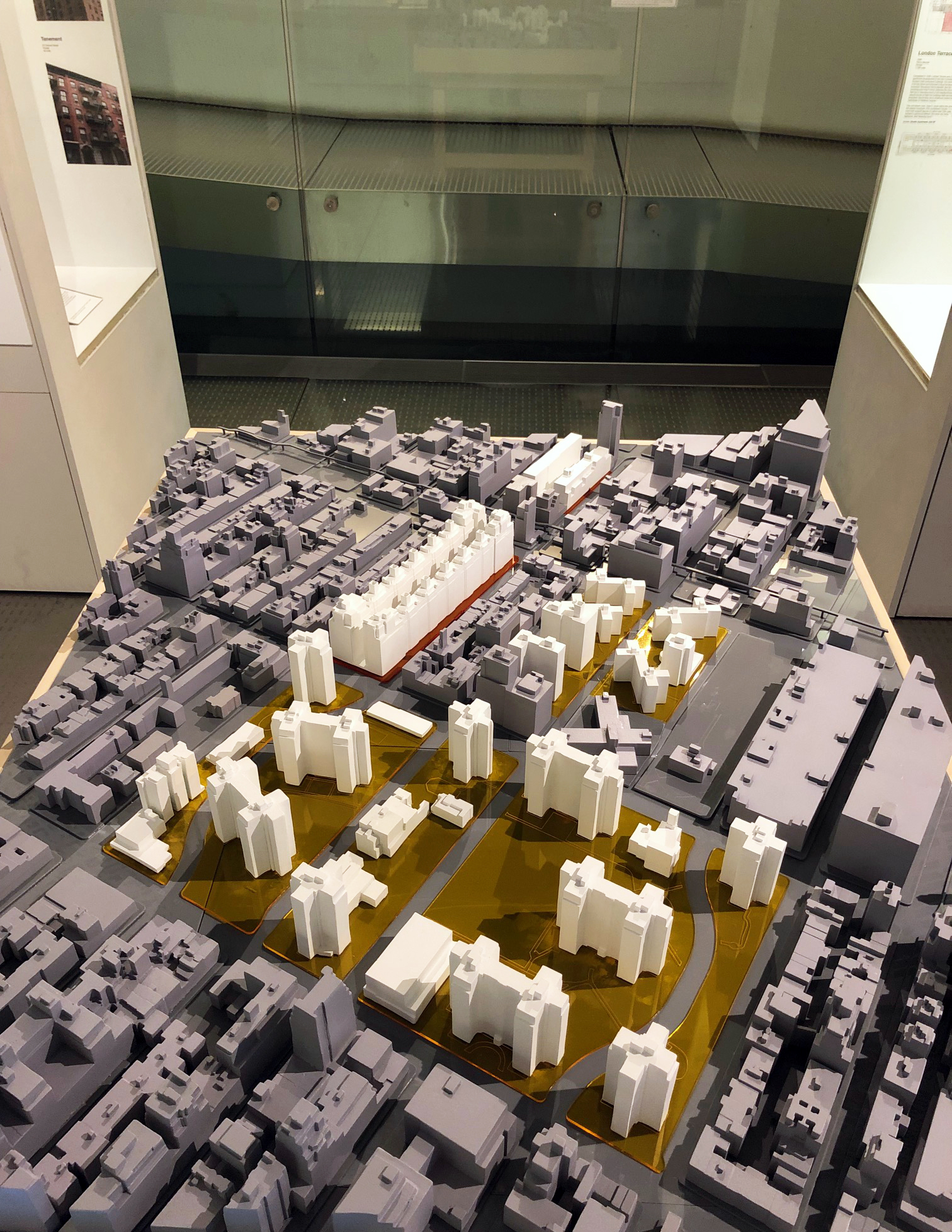
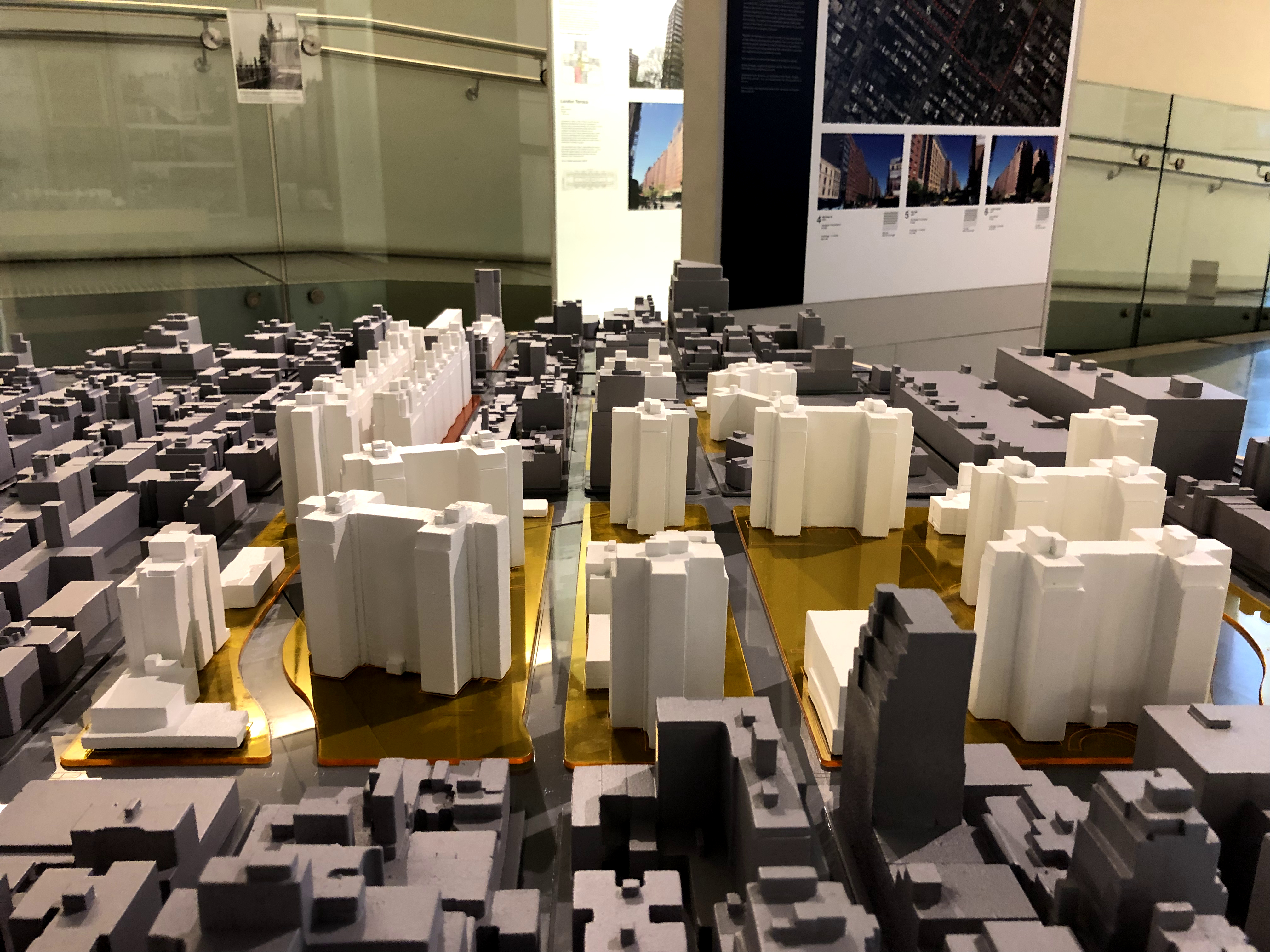
Two recent market-rate rentals, The Tate (2002) and 555 W 23 (2005), frame a block west of Tenth Avenue and pack apartments into 14-story structures, creating densities of 775 and 800 pp/acre, respectively, by taking advantage of special zoning incentives implemented for the High Line district.
The other major projects highlighted in the model are public, or publicly-assisted housing. The western blocks of cruciform and slab towers set in ample open space are NYCHA’s Elliott (1947) and Chelsea Houses (1954), which both have densities of less than 300 pp/acre and cover only about one-fifth of their land with buildings.
The expansive open space at the center of the model is the superblock of Penn South (1962), a limited-equity housing cooperative housing project that de-mapped cross streets between 23rd and 29th streets and Eighth and Ninth avenues. Even though Penn South’s towers rise to 22 stories, the low lot coverage of 20 percent yields an average per person density across the site of just 302 pp/ acre – one third the population density of London Terrace.
The underlying transparent yellow acrylic indicates blocks that are under-built in relation to the zoning law implemented in 1961 and revised in subsequent decades. The transparent red acrylic shows blocks that are overbuilt according to contemporary zoning.
East Harlem
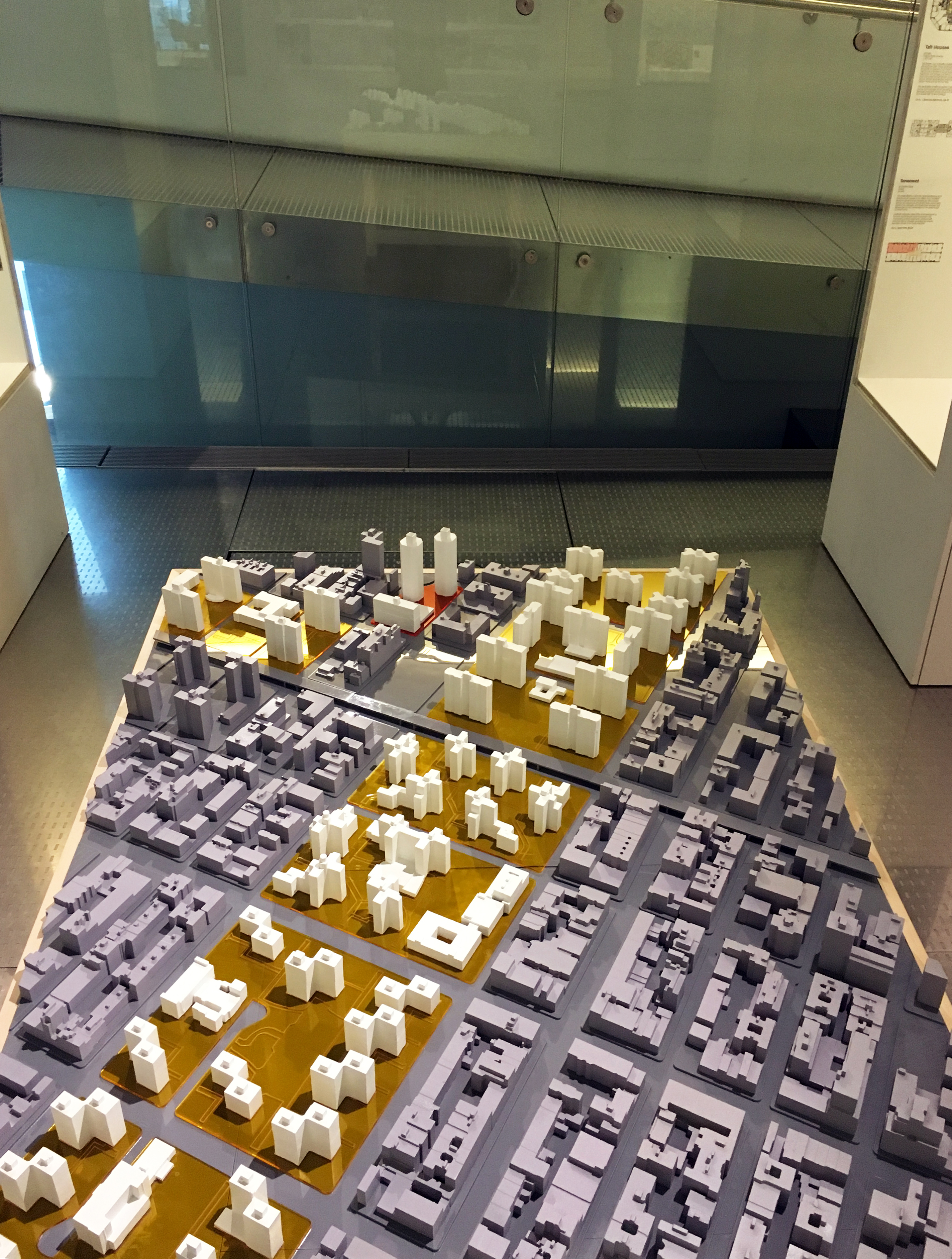
This context model, showing a portion of East Harlem, illustrates the massive reduction in built density that resulted from city officials’ and NYCHA’s ambitious redevelopment program that targeted Harlem since the 1940s. The grey blocks of low or medium-rise buildings are mostly tenements, townhouses, or commercial structures that once covered much of the neighborhood. By 1957, NYCHA had cleared 137 acres of compact blocks like these to make space for its towers in the park.
Highlighted in white are NYCHA projects including Johnson Houses (1948), King Towers (1954), Jefferson Houses (1959), Taft Houses (1962), and Lehman Village (1963). The transparent yellow acrylic that underlies the NYCHA projects indicates that are under-built according to current New York zoning. Indeed, the multiple variations of “tower in the park” planning range in lot coverage, or built density, from just 16 to 20 percent.
The model also includes the twin octagonal towers of Schomburg Plaza (1974), a publicly-assisted Mitchell-Lama project built by the New York State Urban Development Corporation. The UDC’s exemption from the city’s zoning laws allowed for both the innovative design and higher density of lot coverage and people per acre – 63 percent and 677 people per acre – numbers otherwise found only in private-market models such as Manhattan House. The transparent red acrylic under Schomburg Plaza indicates it is more dense than zoning would allow.